Aerial Services

Aerial Photos & Video
Aerial Photography and Videography is a skill set of awareness, experience and control to capture the best action at the right time to produce all kinds of end-products. Request High-quality 4K RAW images or opt for full editing and finalized photo set or finalized cinematic production.
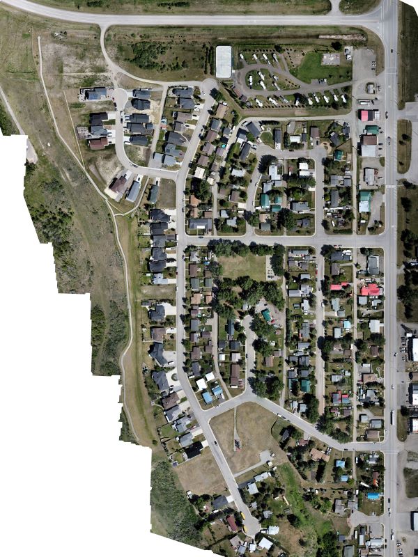
Orthomosaic
An orthophoto is a geometrically corrected collection of photos of an area which are combined, resulting in a large area map in a single image. Orthophotos can be used in many mapping and data collection situations for residential, agriculture, industrial and commercial area inspections, monitoring and progression comparison. Insurance estimates, town planning and crop assessments are aided by orthophoto collections.
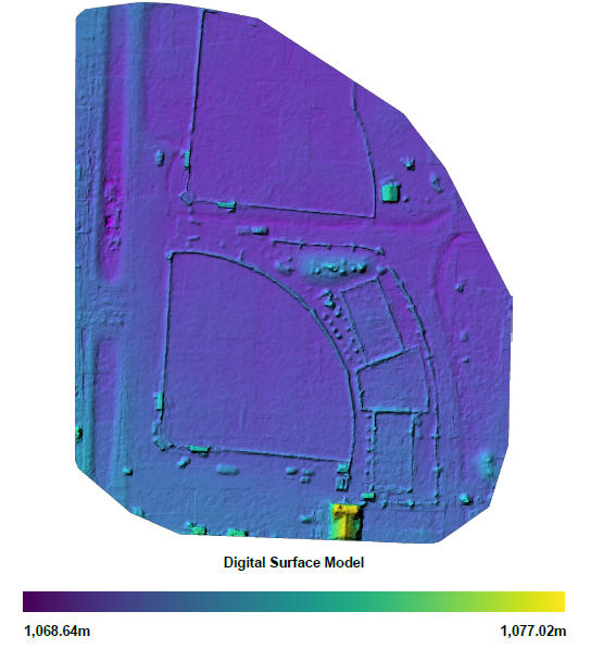
Digital Surface & Terrain Model (DSM/DTM +/- Contour Map)
A Digital Surface or Terrain Model (DSM) is a digitally created model of the base-level surface/terrain of the survey area using RGB point-data from a detailed style of aerial survey. Contour maps for hydrology, flood mitigation and development planning or solar installation inspection.
The most precise and complete method is via Light Detection and Radiation (LIDAR) technology mounted on a drone. This is highly useful when a detailed assessment of an area and all of its features is required such as within dense, dark, erratic or remote areas of surface survey.
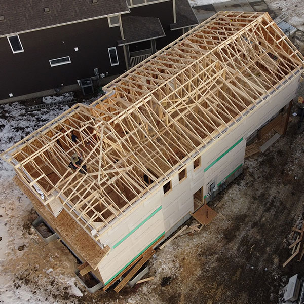
Aerial Inspection
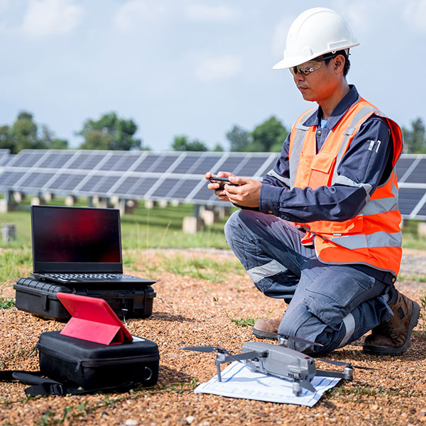
Aerial Inspection is highly useful tool to investigate structural issues, construction progress, quality assurance and accountability reporting. These inspections combine optics with horizontal, vertical and oblique mapping, targeted photos, action-video recordings, GPS data and GCPs to present comprehensive analysis based on client requirements. Aerial inspection can be a much safer, cost effective and complete solution than classical manual inspection alternatives. THERMAL/FLIR available for custom requests or Solar installation inspections.
Precision Agriculture
Precision Agriculture solutions offer the ability to produce detailed crop health assessment maps, create variable rate fertilizer prescriptions, detect weeds, pests or other abnormal growth on farmland using state-of-the-art multispectral imaging drone technology.
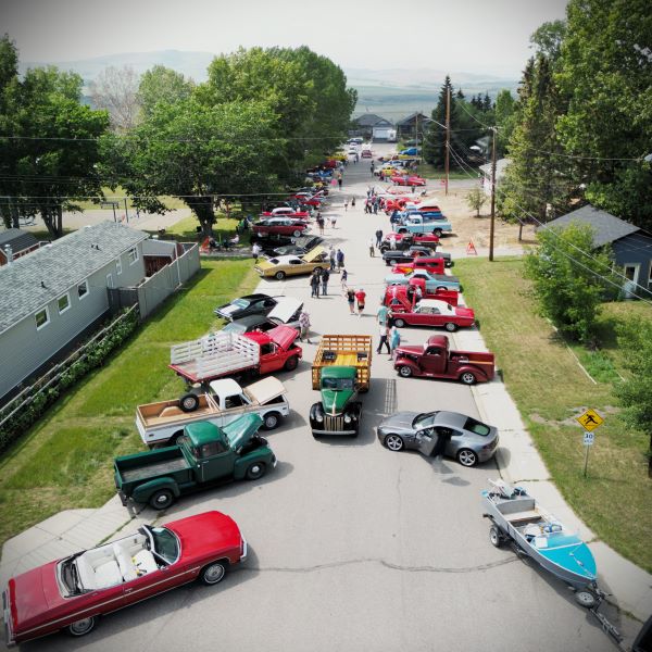
Outdoor/Indoor Events
Aerial cinematic presentations for partial or complete exhibition of the events in your area is a great way to collect media for future sponsorship, affiliation, social networking and participation of both vendors and patrons. Birthdays, Graduations, Weddings, Sporting Events/Team Photos, School Class Photos, Field Trips and reunions are all events where a new angle can bring an advantage into making memories. Canadian Drone Regulations require permit applications to be made in advance of publicized events- so be sure to book early!

Moving Memories
Making Moving Memories to remember and enjoy the re-experience of the moments that bring us the Joy. Aerial photo and video during a family outing or visiting an important place with loved ones can be an amazing way to bring memories to Life and bring the earth, sky and your special people all together. Your own media can also be used to help develop a fully involved cinematic timeline for various memorable occasions or in Celebrations of Life. Let our team take the stress out of the process by bringing together all of the moving parts.
RPAS Education and Flight Reviews
RPAS training presentations, exam preparation, flight review preparation, learning to use your drone and flight reviews can be provided for aspiring pilots. SAR Drone related education is in development as new resources become available for training and information sessions.
(IN DEVELOPMENT, Referral Resource Only)
Why Aerial Advantage?
Aerial Advantage is a place to bring new perspectives to the forefront with aerial drone photography- we take people to a new height in the sky.
Exceptional creative media and videography team captures special moments with family and friends or amazing places for you to enjoy over and over again.
Detailed technical aerial investigations assist a variety of industries to produce high-quality and professional media analysis results.
Advanced software experience is applied to create Orthophotos and Photogrammetry productions that are accurate and complete.
Grow Your Business
Expand Deliverables
High Quality Data Collection
Visual Timelines
Quick Delivery Turnaround
Efficient and Multifunctional
Remote Location Ready
Safe-Access Assessments